
Fallston topographic map
Click on the map to display elevation.
About this map
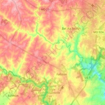
Name: Fallston topographic map, elevation, terrain.
Location: Fallston, Harford County, Maryland, 21047, United States (39.49926 -76.51273 39.57042 -76.38521)
Average elevation: 433 ft
Minimum elevation: 174 ft
Maximum elevation: 617 ft
Harford County trails, hiking, mountain biking, running and outdoor activities