
Grant topographic map
Click on the map to display elevation.
About this map
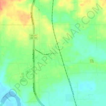
Name: Grant topographic map, elevation, terrain.
Location: Grant, Choctaw County, Oklahoma, 74738, United States (33.92280 -95.53504 33.96280 -95.49504)
Average elevation: 469 ft
Minimum elevation: 410 ft
Maximum elevation: 548 ft
Choctaw County trails, hiking, mountain biking, running and outdoor activities
Other topographic maps
Click on a map to view its topography, its elevation and its terrain.