Geolocate

Greene topographic map

Click on the map to display elevation.

About this map

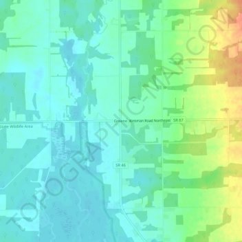
Name: Greene topographic map, elevation, terrain.

Location: Greene, Trumbull County, Ohio, United States (41.44200 -80.76647 41.48200 -80.72647)

Average elevation: 945 ft

Minimum elevation: 902 ft

Maximum elevation: 1,047 ft

Trumbull County trails, hiking, mountain biking, running and outdoor activities

Gear up for your next adventure:

📷Action Cameras - Rugged cameras to document your journeys across rugged terrain
🔥Plasma Lighters - Windproof lighters that work in any weather condition
🎒Waterproof Dry Bags - Keep your electronics and maps dry inside your pack
🥤Water Filter Bottle - All‑in‑one filter bottle for safe hydration
📱Heavy-Duty Phone Cases - Drop-proof and waterproof protection for outdoor navigation

As an Amazon Associate, this site earns from qualifying purchases at no extra cost to you.