Geolocate

Alva topographic map

Click on the map to display elevation.

About this map

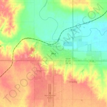
Name: Alva topographic map, elevation, terrain.

Location: Alva, Woods County, Oklahoma, 73717, United States (36.76305 -98.70603 36.84305 -98.62603)

Average elevation: 1,401 ft

Minimum elevation: 1,289 ft

Maximum elevation: 1,506 ft

Woods County trails, hiking, mountain biking, running and outdoor activities

Gear up for your next adventure:

🎒Gear Packing Cubes - Organize your backpack efficiently
🕶️GPS Smartphone Mount - Secure mount for phone navigation
🪶Trail Camera - Capture wildlife on your hikes
🔊Portable Camp Speaker - Music and alerts at camp
🧦Hiking Socks - Comfortable socks to prevent blisters on long hikes

As an Amazon Associate, this site earns from qualifying purchases at no extra cost to you.