Geolocate

Butler topographic map

Click on the map to display elevation.

About this map

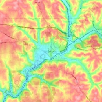
Name: Butler topographic map, elevation, terrain.

Location: Butler, Butler County, Pennsylvania, 16003, United States (40.82108 -79.93520 40.90108 -79.85520)

Average elevation: 1,194 ft

Minimum elevation: 981 ft

Maximum elevation: 1,365 ft

Butler County trails, hiking, mountain biking, running and outdoor activities

Gear up for your next adventure:

🪶LED Camping Lantern - Bright lantern for camp lighting
🧥Men's Rain Shells - Premium waterproof and breathable jackets for mountain weather
🏕️Family Camping Gear - Essentials for group camping trips
🎒Trekking Poles - Sturdy poles for balance and stability on rough terrain
🦶Hiking Gaiters - Keep debris and water out of your boots

As an Amazon Associate, this site earns from qualifying purchases at no extra cost to you.