
Thank you for supporting this site ❤️
Make a donation
Make a donation
Gear up for your next adventure:
As an Amazon Associate, this site earns from qualifying purchases at no extra cost to you.
Fassfern topographic map
Click on the map to display elevation.
Thank you for supporting this site ❤️
Make a donation
Make a donation
Gear up for your next adventure:
As an Amazon Associate, this site earns from qualifying purchases at no extra cost to you.
About this map
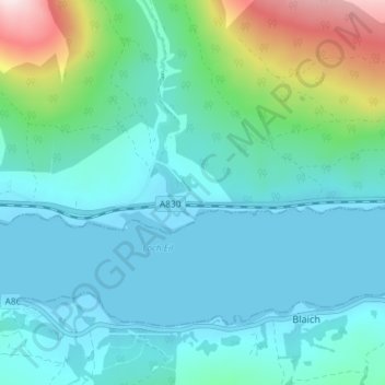
Name: Fassfern topographic map, elevation, terrain.
Location: Fassfern, Highland, Scotland, PH33 7NP, United Kingdom (56.83645 -5.26050 56.87645 -5.22050)
Average elevation: 276 ft
Minimum elevation: -7 ft
Maximum elevation: 1,506 ft
Thank you for supporting this site ❤️
Make a donation
Make a donation
Gear up for your next adventure:
As an Amazon Associate, this site earns from qualifying purchases at no extra cost to you.