Geolocate

Summit City topographic map

Click on the map to display elevation.

About this map

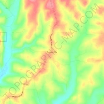
Name: Summit City topographic map, elevation, terrain.

Location: Summit City, Ozark County, Missouri, 65715, United States (36.71923 -92.63378 36.75923 -92.59378)

Average elevation: 984 ft

Minimum elevation: 817 ft

Maximum elevation: 1,145 ft

Ozark County trails, hiking, mountain biking, running and outdoor activities

Gear up for your next adventure:

🪶Camping Sleeping Pad - Comfortable sleeping pad for backpacking
🛶Inflatable Kayak - Portable kayak for rivers, lakes, and expeditions
🥄Camping Utensil Set - Lightweight utensils for outdoor meals
🧷Carabiner Set - Durable clips for gear attachment
🔌Solar Panel Charger - Charge gear sustainably outdoors

As an Amazon Associate, this site earns from qualifying purchases at no extra cost to you.