
Thank you for supporting this site ❤️
Make a donation
Make a donation
Gear up for your next adventure:
As an Amazon Associate, this site earns from qualifying purchases at no extra cost to you.
Lobão topographic map
Click on the map to display elevation.
Thank you for supporting this site ❤️
Make a donation
Make a donation
Gear up for your next adventure:
As an Amazon Associate, this site earns from qualifying purchases at no extra cost to you.
About this map
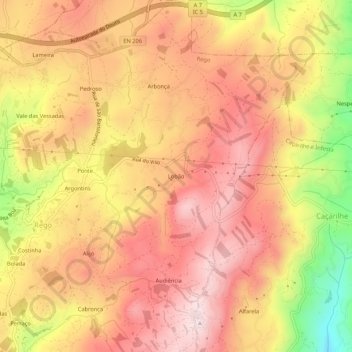
Name: Lobão topographic map, elevation, terrain.
Location: Lobão, Rego, Celorico de Basto, Braga, 4820-840, Portugal (41.40863 -8.08637 41.44863 -8.04637)
Average elevation: 2,231 ft
Minimum elevation: 1,286 ft
Maximum elevation: 2,766 ft
Thank you for supporting this site ❤️
Make a donation
Make a donation
Gear up for your next adventure:
As an Amazon Associate, this site earns from qualifying purchases at no extra cost to you.