
Thank you for supporting this site ❤️
Make a donation
Make a donation
Gear up for your next adventure:
As an Amazon Associate, this site earns from qualifying purchases at no extra cost to you.
Kiphire topographic map
Click on the map to display elevation.
Thank you for supporting this site ❤️
Make a donation
Make a donation
Gear up for your next adventure:
As an Amazon Associate, this site earns from qualifying purchases at no extra cost to you.
About this map
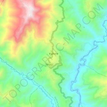
Name: Kiphire topographic map, elevation, terrain.
Location: Kiphire, Kiphire Sadar, Kiphire, Nagaland, 798611, India (25.84673 94.74635 25.92673 94.82635)
Average elevation: 3,248 ft
Minimum elevation: 1,621 ft
Maximum elevation: 6,772 ft
Thank you for supporting this site ❤️
Make a donation
Make a donation
Gear up for your next adventure:
As an Amazon Associate, this site earns from qualifying purchases at no extra cost to you.