
Thank you for supporting this site ❤️
Make a donation
Make a donation
Gear up for your next adventure:
As an Amazon Associate, this site earns from qualifying purchases at no extra cost to you.
Saguiaran topographic map
Click on the map to display elevation.
Thank you for supporting this site ❤️
Make a donation
Make a donation
Gear up for your next adventure:
As an Amazon Associate, this site earns from qualifying purchases at no extra cost to you.
About this map
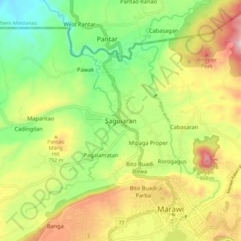
Name: Saguiaran topographic map, elevation, terrain.
Location: Saguiaran, Lanao del Sur, Bangsamoro, 09700, Philippines (7.99408 124.22872 8.07408 124.30872)
Average elevation: 2,172 ft
Minimum elevation: 1,299 ft
Maximum elevation: 3,340 ft
Thank you for supporting this site ❤️
Make a donation
Make a donation
Gear up for your next adventure:
As an Amazon Associate, this site earns from qualifying purchases at no extra cost to you.