Geolocate

Ketsingen topographic map

Click on the map to display elevation.

About this map

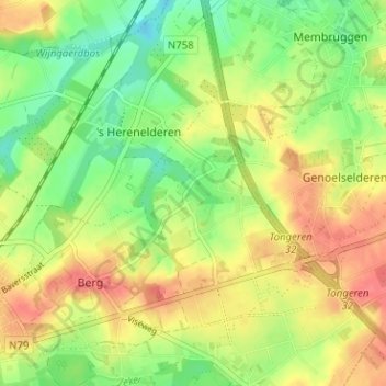
Name: Ketsingen topographic map, elevation, terrain.

Location: Ketsingen, Berg, Tongeren, Limburg, Vlaanderen, 3700, België (50.78005 5.49197 50.82005 5.53197)

Average elevation: 305 ft

Minimum elevation: 207 ft

Maximum elevation: 404 ft

Gear up for your next adventure:

🔋Solar Power Banks - Keep your GPS and phone charged in remote wilderness areas
🪑Portable Camp Table - Compact table for campsite meals
🎒Outdoor Daypacks - Lightweight backpacks designed for carrying maps and essential gear
🥘Titanium Cookware - Durable, featherlight pots and pans for backpacking
🛌Ultralight Sleeping Bags - Compact down bags for cold nights in the wilderness

As an Amazon Associate, this site earns from qualifying purchases at no extra cost to you.