
Thank you for supporting this site ❤️
Make a donation
Make a donation
Gear up for your next adventure:
As an Amazon Associate, this site earns from qualifying purchases at no extra cost to you.
Percozzone topographic map
Click on the map to display elevation.
Thank you for supporting this site ❤️
Make a donation
Make a donation
Gear up for your next adventure:
As an Amazon Associate, this site earns from qualifying purchases at no extra cost to you.
About this map
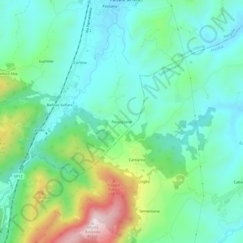
Name: Percozzone topographic map, elevation, terrain.
Location: Percozzone, Pergola, Pesaro e Urbino, Marche, 61045, Italia (43.49785 12.81938 43.53785 12.85938)
Average elevation: 1,362 ft
Minimum elevation: 919 ft
Maximum elevation: 2,589 ft
Thank you for supporting this site ❤️
Make a donation
Make a donation
Gear up for your next adventure:
As an Amazon Associate, this site earns from qualifying purchases at no extra cost to you.