
Chico topographic map
Click on the map to display elevation.
Chico
An altitude record for unmanned gas balloons was set in Chico in October 1972 (51.8 km or 32.2 mi). The record was broken on May 23, 2002.
About this map
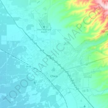
Name: Chico topographic map, elevation, terrain.
Location: Chico, Butte County, California, United States (39.68754 -121.91222 39.81753 -121.71237)
Average elevation: 312 ft
Minimum elevation: 118 ft
Maximum elevation: 1,680 ft
Butte County trails, hiking, mountain biking, running and outdoor activities
Other topographic maps
Click on a map to view its topography, its elevation and its terrain.
Stirling City
United States > California > Butte County
Stirling City is a census-designated place in Butte County, California, located on Paradise Ridge in the western foothills of the Sierra Nevada. Contrary to its name, Stirling City is not a city. Its ZIP Code is 95978 and area code 530. It lies at an elevation of 3570 feet (1088 m). Stirling City had a…
Average elevation: 3,425 ft