
Friendsville topographic map
Click on the map to display elevation.
Friendsville
Friendsville is located in western Blount County. The town is situated along State Route 333 (Miser Station Road) and stretches from Fort Loudoun Lake in the north to U.S. Route 321 (Lamar Alexander Parkway). It lies at an elevation of 879 feet (268 m).
About this map
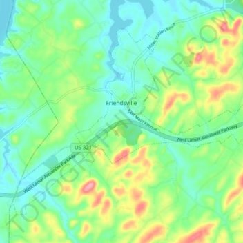
Name: Friendsville topographic map, elevation, terrain.
Average elevation: 919 ft
Minimum elevation: 810 ft
Maximum elevation: 1,155 ft
Blount County trails, hiking, mountain biking, running and outdoor activities
Other topographic maps
Click on a map to view its topography, its elevation and its terrain.