
Thank you for supporting this site ❤️
Make a donation
Make a donation
Gear up for your next adventure:
As an Amazon Associate, this site earns from qualifying purchases at no extra cost to you.
Badiyakot topographic map
Click on the map to display elevation.
Thank you for supporting this site ❤️
Make a donation
Make a donation
Gear up for your next adventure:
As an Amazon Associate, this site earns from qualifying purchases at no extra cost to you.
About this map
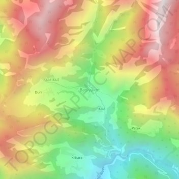
Name: Badiyakot topographic map, elevation, terrain.
Location: Badiyakot, Kapkot, Bageshwar, Uttarakhand, India (30.09173 79.82416 30.13173 79.86416)
Average elevation: 8,143 ft
Minimum elevation: 5,676 ft
Maximum elevation: 10,623 ft
Thank you for supporting this site ❤️
Make a donation
Make a donation
Gear up for your next adventure:
As an Amazon Associate, this site earns from qualifying purchases at no extra cost to you.