
Thank you for supporting this site ❤️
Make a donation
Make a donation
Gear up for your next adventure:
As an Amazon Associate, this site earns from qualifying purchases at no extra cost to you.
Dagundalahon topographic map
Click on the map to display elevation.
Thank you for supporting this site ❤️
Make a donation
Make a donation
Gear up for your next adventure:
As an Amazon Associate, this site earns from qualifying purchases at no extra cost to you.
About this map
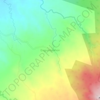
Name: Dagundalahon topographic map, elevation, terrain.
Location: Dagundalahon, Bukidnon, Northern Mindanao, 8708, Philippines (8.11893 124.64368 8.15893 124.68368)
Average elevation: 2,287 ft
Minimum elevation: 1,667 ft
Maximum elevation: 3,314 ft
Thank you for supporting this site ❤️
Make a donation
Make a donation
Gear up for your next adventure:
As an Amazon Associate, this site earns from qualifying purchases at no extra cost to you.