
Vista topographic map
Click on the map to display elevation.
About this map
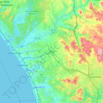
Name: Vista topographic map, elevation, terrain.
Location: Vista, San Diego County, California, 92083, United States (33.04004 -117.40254 33.36004 -117.08254)
Average elevation: 466 ft
Minimum elevation: -16 ft
Maximum elevation: 2,083 ft
San Diego County trails, hiking, mountain biking, running and outdoor activities
Other topographic maps
Click on a map to view its topography, its elevation and its terrain.