
Make a donation
Gear up for your next adventure:
As an Amazon Associate, this site earns from qualifying purchases at no extra cost to you.
Zoersel topographic map
Click on the map to display elevation.
Make a donation
Gear up for your next adventure:
As an Amazon Associate, this site earns from qualifying purchases at no extra cost to you.
Zoersel
Zoersel ligt in de Kempen op een hoogte van 13-22 meter. De omgeving is bosrijk. Vooral het Zoerselbos is een uitgestrekt natuurgebied met diverse wandel- en fietsroutes.
Make a donation
Gear up for your next adventure:
As an Amazon Associate, this site earns from qualifying purchases at no extra cost to you.
About this map
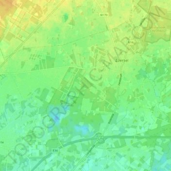
Name: Zoersel topographic map, elevation, terrain.
Location: Zoersel, Antwerpen, België (51.23926 4.64402 51.28566 4.74334)
Average elevation: 52 ft
Minimum elevation: 13 ft
Maximum elevation: 95 ft
Make a donation
Gear up for your next adventure:
As an Amazon Associate, this site earns from qualifying purchases at no extra cost to you.