Geolocate

Happy Valley topographic map

Click on the map to display elevation.

About this map

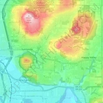
Name: Happy Valley topographic map, elevation, terrain.

Location: Happy Valley, Clackamas County, Oregon, 97086, USA (45.40314 -122.56833 45.46130 -122.47706)

Average elevation: 410 ft

Minimum elevation: 62 ft

Maximum elevation: 1,079 ft

Gear up for your next adventure:

🕶️GPS Smartphone Mount - Secure mount for phone navigation
🧭Pro Hiking Compasses - High-accuracy liquid-filled compasses for topographic orientation
🚗GPS Dash Cams - Record your scenic drives through mountain passes and canyons
🌎3D Topographic Globes - Raised relief globes for a tactile understanding of geography
🔭Telescopic Hiking Pole - Adjustable pole for hiking stability

As an Amazon Associate, this site earns from qualifying purchases at no extra cost to you.