
Ogden topographic map
Interactive map
Click on the map to display elevation.
About this map
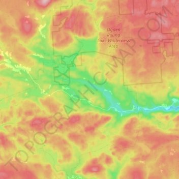
Name: Ogden topographic map, elevation, terrain.
Average elevation: 417 ft
Minimum elevation: 75 ft
Maximum elevation: 699 ft
Other topographic maps
Click on a map to view its topography, its elevation and its terrain.
Susies Lake
Canada > Nova Scotia > Ogden
Susies Lake, South River Lake Road, Ogden, Guysborough District Municipality, Guysborough County, Nova Scotia, Canada
Average elevation: 312 ft