Geolocate

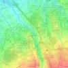
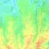
Zone 4 topographic map

Click on the map to display elevation.

About this map

Name: Zone 4 topographic map, elevation, terrain.

Location: Zone 4, Poblacion, Dasmariñas, Cavite, Calabarzon, Philippines (14.32157 120.93540 14.33058 120.94577)

Average elevation: 289 ft

Minimum elevation: 203 ft

Maximum elevation: 404 ft

Other topographic maps

Click on a map to view its topography, its elevation and its terrain.
Mango Village

Philippines > Cavite > Dasmarinas

Average elevation: 207 ft

Luksuhin Dam

Philippines > Cavite > Dasmarinas

Average elevation: 417 ft

Pasong Tinta

Philippines > Cavite > Dasmarinas

Average elevation: 259 ft

Piela

Philippines > Cavite > Dasmarinas > Piela

Average elevation: 558 ft

Humayao

Philippines > Cavite > Dasmarinas

Average elevation: 663 ft

Tibagan

Philippines > Cavite > Dasmarinas

Average elevation: 236 ft

Malipay

Philippines > Cavite > Dasmarinas

Average elevation: 233 ft

Gear up for your next adventure:

🧢Outdoor Hiking Hat - Sun protection hat for outdoor explorers
🩳Quick‑Dry Hiking Shorts - Comfortable and quick‑dry shorts for summer hiking
⌚Solar GPS Watches - Advanced multisport watches with built-in topographic maps
📷Action Cameras - Rugged cameras to document your journeys across rugged terrain
🧣Hiking Neck Gaiter - Multi‑use neck protection for outdoor weather

As an Amazon Associate, this site earns from qualifying purchases at no extra cost to you.