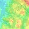
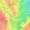
Campbell topographic map
Click on the map to display elevation.
About this map

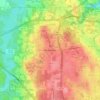
Name: Campbell topographic map, elevation, terrain.
Location: Campbell, Mahoning County, Ohio, 44405, United States (41.06159 -80.61602 41.09122 -80.55951)
Average elevation: 1,017 ft
Minimum elevation: 814 ft
Maximum elevation: 1,165 ft
Other topographic maps
Click on a map to view its topography, its elevation and its terrain.


Juliana Kurinka Play Area
United States > Ohio > Mahoning County > Youngstown
Average elevation: 994 ft