Geolocate

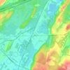
Succasunna topographic map

Click on the map to display elevation.

About this map

Name: Succasunna topographic map, elevation, terrain.

Location: Succasunna, Roxbury Township, Morris County, New Jersey, 07876, United States (40.82614 -74.69094 40.87704 -74.62140)

Average elevation: 794 ft

Minimum elevation: 623 ft

Maximum elevation: 1,211 ft

Morris County trails, hiking, mountain biking, running and outdoor activities

Other topographic maps

Click on a map to view its topography, its elevation and its terrain.
Gear up for your next adventure:

🧣Merino Neck Gaiters - Multi-functional headwear for wind and sun protection
🔭Compact Binoculars - HD vision for scouting terrain and identifying distant landmarks
🌲Outdoor Survival Books - Best books on survival skills
🧥Men's Rain Shells - Premium waterproof and breathable jackets for mountain weather
👟Trail Running Shoes - Lightweight shoes for trail runners

As an Amazon Associate, this site earns from qualifying purchases at no extra cost to you.