Geolocate

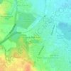
Model Town topographic map

Click on the map to display elevation.

About this map

Name: Model Town topographic map, elevation, terrain.

Location: Model Town, Keshavpuram, Delhi, Central North Delhi, Delhi, India (28.70261 77.18044 28.71210 77.19657)

Average elevation: 699 ft

Minimum elevation: 673 ft

Maximum elevation: 725 ft

Other topographic maps

Click on a map to view its topography, its elevation and its terrain.
Yamuna Biodiversity Park

India > Delhi > Delhi

Average elevation: 686 ft

Aastha Kunj

India > Delhi > Delhi

Average elevation: 732 ft

Ghitorni

India > Delhi > Delhi

Average elevation: 879 ft

Gear up for your next adventure:

🌎3D Topographic Globes - Raised relief globes for a tactile understanding of geography
🗺️Topographic Maps - Detailed topo maps for hiking, exploring and outdoor navigation
🪶LED Camping Lantern - Bright lantern for camp lighting
📡GPS Antenna Upgrade - Enhance GPS reception in remote terrain
🪵Folding Camp Saw - Compact saw for wood and campsite work

As an Amazon Associate, this site earns from qualifying purchases at no extra cost to you.