Geolocate

Gitega topographic map

Click on the map to display elevation.

About this map
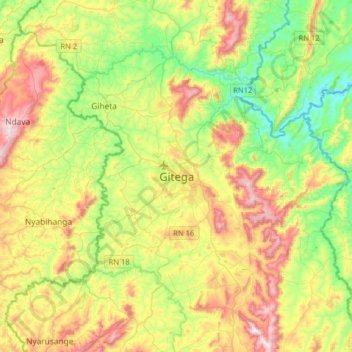
Name: Gitega topographic map, elevation, terrain.

Location: Gitega, Burundi (-3.58850 29.76497 -3.26850 30.08497)

Average elevation: 5,400 ft

Minimum elevation: 4,531 ft

Maximum elevation: 6,752 ft

Gear up for your next adventure:

💧Water Filtration Bottles - Safely drink from streams and lakes while exploring
🛰️Satellite Messengers - Emergency SOS and two-way messaging for off-grid adventures
🛠️Backpacking Tool Kit - Essential toolkit for outdoor repairs
🎒Trekking Poles - Sturdy poles for balance and stability on rough terrain
🔦LED Headlamp - Bright and durable LED headlamp for night navigation

As an Amazon Associate, this site earns from qualifying purchases at no extra cost to you.