Geolocate

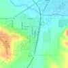
Burdock topographic map

Click on the map to display elevation.

About this map

Name: Burdock topographic map, elevation, terrain.

Location: Burdock, Argentine Township, Fall River County, South Dakota, United States (43.44303 -104.00326 43.46303 -103.98326)

Average elevation: 3,619 ft

Minimum elevation: 3,543 ft

Maximum elevation: 3,737 ft

Other topographic maps

Click on a map to view its topography, its elevation and its terrain.

Hot Springs

United States > South Dakota > Fall River County

Average elevation: 3,757 ft

Edgemont

United States > South Dakota > Fall River County

Average elevation: 3,481 ft

Edgemont

United States > South Dakota > Fall River County

Average elevation: 3,481 ft

Edgemont

United States > South Dakota > Fall River County

Average elevation: 3,481 ft

Gear up for your next adventure:

🦟Ultrasonic Repellers - Create a bug-free zone at your camp or rest stop
💧Water Purification System - Clean water on the trail with reliable purifiers
🕶️Glacier Sunglasses - Side shields to protect eyes from high-altitude snow glare
🔭Compact Binoculars - HD vision for scouting terrain and identifying distant landmarks
🛰️Satellite Messengers - Emergency SOS and two-way messaging for off-grid adventures

As an Amazon Associate, this site earns from qualifying purchases at no extra cost to you.