Geolocate

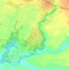
Belung topographic map

Click on the map to display elevation.

About this map

Name: Belung topographic map, elevation, terrain.

Location: Belung, Kabupaten Malang, East Java, 65157, Indonesia (-8.05227 112.74782 -8.01227 112.78782)

Average elevation: 2,142 ft

Minimum elevation: 1,867 ft

Maximum elevation: 2,477 ft

Other topographic maps

Click on a map to view its topography, its elevation and its terrain.
Pulau Sempu

Indonesia > East Java > Kabupaten Malang

Average elevation: 85 ft

Sungai Brantas

Indonesia > East Java > Kabupaten Malang > Sukoraharjo

Average elevation: 1,391 ft

Tegalsari

Indonesia > East Java > Kabupaten Malang

Average elevation: 1,040 ft

Pulau Sempu

Indonesia > East Java > Kabupaten Malang

Average elevation: 85 ft

Gear up for your next adventure:

🗺️Topographic Maps - Detailed topo maps for hiking, exploring and outdoor navigation
🔥Plasma Lighters - Windproof lighters that work in any weather condition
🛶Inflatable Kayak - Portable kayak for rivers, lakes, and expeditions
🪶Survival Guide Book - Expert advice for emergency preparedness
📡Handheld GPS Device - Reliable handheld GPS for outdoor navigation

As an Amazon Associate, this site earns from qualifying purchases at no extra cost to you.