Geolocate

Hannibal topographic map

Click on the map to display elevation.

About this map

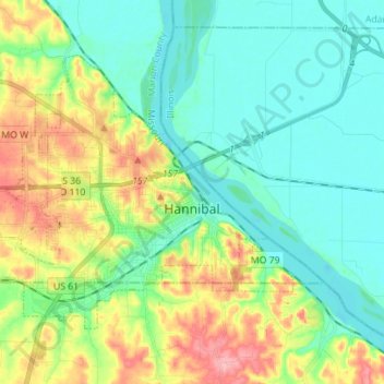
Name: Hannibal topographic map, elevation, terrain.

Location: Hannibal, Marion County, Missouri, 63401, United States (39.67459 -91.46142 39.75113 -91.32195)

Average elevation: 558 ft

Minimum elevation: 440 ft

Maximum elevation: 820 ft

Marion County trails, hiking, mountain biking, running and outdoor activities

Gear up for your next adventure:

🔥Camping Stove - Portable stove for camping and backcountry cooking
🎒Day Hiking Backpack - Lightweight backpack perfect for day trips and outdoor adventures
🪑Portable Camp Table - Compact table for campsite meals
🌡️Portable Weather Meter - Track weather conditions on the trail
🎁Geography Themed Gifts - Unique gift ideas for map lovers and geography enthusiasts

As an Amazon Associate, this site earns from qualifying purchases at no extra cost to you.