Geolocate

Talara topographic map

Click on the map to display elevation.

About this map
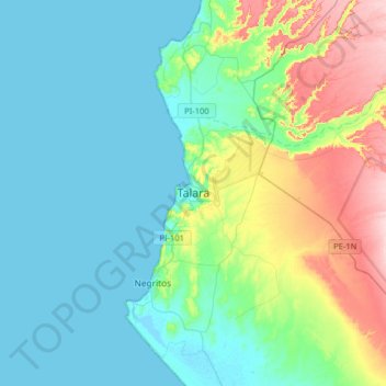
Name: Talara topographic map, elevation, terrain.

Location: Talara, Pariñas, Province of Talara, Piura, Peru (-4.61969 -81.31183 -4.53969 -81.23183)

Average elevation: 138 ft

Minimum elevation: -3 ft

Maximum elevation: 308 ft

Gear up for your next adventure:

🧯Emergency Survival Kit - All‑in‑one survival essentials for the backcountry
🧦Hiking Socks - Comfortable socks to prevent blisters on long hikes
🎒Day Hiking Backpack - Lightweight backpack perfect for day trips and outdoor adventures
🖼️Topo Map Wall Art - Decorative topographic prints of famous peaks and regions
🛌Ultralight Sleeping Bags - Compact down bags for cold nights in the wilderness

As an Amazon Associate, this site earns from qualifying purchases at no extra cost to you.