Geolocate

Timboroa topographic map

Click on the map to display elevation.

About this map
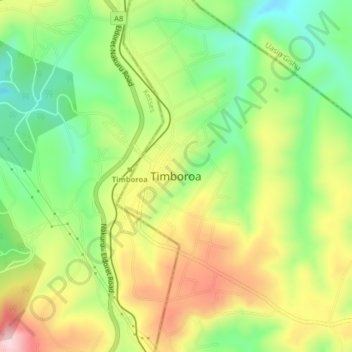
Name: Timboroa topographic map, elevation, terrain.

Location: Timboroa, Eldama Ravine, Baringo, Kenya (0.02296 35.50671 0.10296 35.58671)

Average elevation: 8,848 ft

Minimum elevation: 8,159 ft

Maximum elevation: 9,478 ft

Other topographic maps

Click on a map to view its topography, its elevation and its terrain.

Eldama Ravine

Kenya > Baringo > Eldama Ravine > Eldama Ravine

Average elevation: 7,136 ft

Gear up for your next adventure:

🪵Folding Camp Saw - Compact saw for wood and campsite work
🏕️Tent Footprint - Protect your tent base from wear
🏕️Family Camping Gear - Essentials for group camping trips
🔋Solar Power Banks - Keep your GPS and phone charged in remote wilderness areas
🥩Freeze-Dried Meals - Nutritious and lightweight food for remote expeditions

As an Amazon Associate, this site earns from qualifying purchases at no extra cost to you.