
Costa Occidental topographic map
Interactive map
Click on the map to display elevation.
About this map
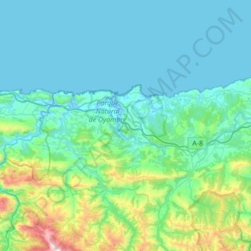
Name: Costa Occidental topographic map, elevation, terrain.
Location: Costa Occidental, Cantabria, España (43.26822 -4.53946 43.42656 -4.04411)
Average elevation: 830 ft
Minimum elevation: -13 ft
Maximum elevation: 6,181 ft
Other topographic maps
Click on a map to view its topography, its elevation and its terrain.
Picos de Europa
Picos de Europa, Cabaña Verónica-Urriellu, Cabrales, Liébana, Cantabria, España
Average elevation: 7,513 ft