Geolocate

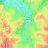
Tomatoes topographic map

Click on the map to display elevation.

About this map

Name: Tomatoes topographic map, elevation, terrain.

Location: Tomatoes, Atlanta, Fulton County, Georgia, 30315, United States (33.69221 -84.37479 33.69231 -84.37469)

Average elevation: 883 ft

Minimum elevation: 781 ft

Maximum elevation: 1,030 ft

Other topographic maps

Click on a map to view its topography, its elevation and its terrain.

Piedmont Park

United States > Georgia > Fulton County > Atlanta

Average elevation: 928 ft

Renaissance Park

United States > Georgia > Fulton County > Atlanta

Average elevation: 994 ft

Grant Park

United States > Georgia > Fulton County > Atlanta

Average elevation: 978 ft

Hardy Ivy Park

United States > Georgia > Fulton County > Atlanta

Average elevation: 1,017 ft

Piedmont Park

United States > Georgia > Fulton County > Atlanta

Average elevation: 928 ft

Central Park

United States > Georgia > Fulton County > Atlanta

Average elevation: 988 ft

Fort McPherson

United States > Georgia > Fulton County > Atlanta

Average elevation: 1,014 ft

Gear up for your next adventure:

📡Handheld GPS Device - Reliable handheld GPS for outdoor navigation
🔦LED Headlamp - Bright and durable LED headlamp for night navigation
🏥Hiking First Aid Kits - Comprehensive medical kits for remote trail injuries
🩹Survival Bandages - High‑quality bandages for emergencies
🪓Survival Multi‑Tool - Versatile tool for camp and trail tasks

As an Amazon Associate, this site earns from qualifying purchases at no extra cost to you.