Geolocate

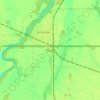
Lancaster topographic map

Click on the map to display elevation.

About this map

Name: Lancaster topographic map, elevation, terrain.

Location: Lancaster, Kittson County, Minnesota, United States (48.84040 -96.82118 48.86967 -96.77669)

Average elevation: 906 ft

Minimum elevation: 869 ft

Maximum elevation: 928 ft

Kittson County trails, hiking, mountain biking, running and outdoor activities

Other topographic maps

Click on a map to view its topography, its elevation and its terrain.
Noyes

United States > Minnesota > Kittson County

Average elevation: 791 ft

Noyes

United States > Minnesota > Kittson County

Average elevation: 791 ft

Gear up for your next adventure:

👖Convertible Hiking Pants - Versatile zip-off pants for changing altitudes and temperatures
🧯Emergency Survival Kit - All‑in‑one survival essentials for the backcountry
📡Handheld GPS Device - Reliable handheld GPS for outdoor navigation
🍳Camping Cook Set - Complete cookware for outdoor meals
🛌Ultralight Sleeping Bags - Compact down bags for cold nights in the wilderness

As an Amazon Associate, this site earns from qualifying purchases at no extra cost to you.