
Thank you for supporting this site ❤️
Make a donation
Make a donation
Gear up for your next adventure:
As an Amazon Associate, this site earns from qualifying purchases at no extra cost to you.
Peñastrosa topographic map
Click on the map to display elevation.
Thank you for supporting this site ❤️
Make a donation
Make a donation
Gear up for your next adventure:
As an Amazon Associate, this site earns from qualifying purchases at no extra cost to you.
About this map
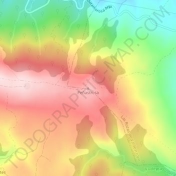
Name: Peñastrosa topographic map, elevation, terrain.
Location: Peñastrosa, Las Rozas de Valdearroyo, Cantabria, 39213, España (42.95954 -4.08403 42.95964 -4.08393)
Average elevation: 3,327 ft
Minimum elevation: 2,772 ft
Maximum elevation: 3,789 ft
Thank you for supporting this site ❤️
Make a donation
Make a donation
Gear up for your next adventure:
As an Amazon Associate, this site earns from qualifying purchases at no extra cost to you.