
Thank you for supporting this site ❤️
Make a donation
Make a donation
Gear up for your next adventure:
As an Amazon Associate, this site earns from qualifying purchases at no extra cost to you.
Canal topographic map
Click on the map to display elevation.
Thank you for supporting this site ❤️
Make a donation
Make a donation
Gear up for your next adventure:
As an Amazon Associate, this site earns from qualifying purchases at no extra cost to you.
About this map
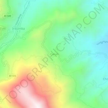
Name: Canal topographic map, elevation, terrain.
Location: Canal, Samugari, La Mar, Ayacucho, Perú (-12.78276 -73.70670 -12.74276 -73.66670)
Average elevation: 3,632 ft
Minimum elevation: 2,418 ft
Maximum elevation: 5,879 ft
Thank you for supporting this site ❤️
Make a donation
Make a donation
Gear up for your next adventure:
As an Amazon Associate, this site earns from qualifying purchases at no extra cost to you.