Geolocate

Howe topographic map

Click on the map to display elevation.

About this map

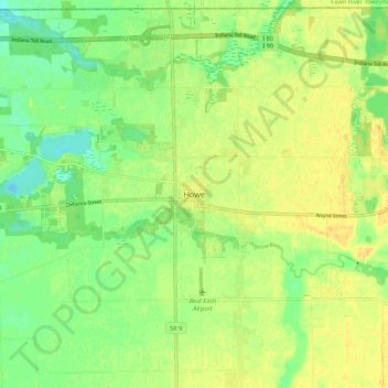
Name: Howe topographic map, elevation, terrain.

Location: Howe, LaGrange County, Indiana, 46746, United States (41.68137 -85.46065 41.76137 -85.38065)

Average elevation: 876 ft

Minimum elevation: 830 ft

Maximum elevation: 909 ft

LaGrange County trails, hiking, mountain biking, running and outdoor activities

Other topographic maps

Click on a map to view its topography, its elevation and its terrain.

Topeka

United States > Indiana > LaGrange County

Average elevation: 932 ft

Shipshewana

United States > Indiana > LaGrange County

Average elevation: 892 ft

Gear up for your next adventure:

🪓Survival Multi‑Tool - Versatile tool for camp and trail tasks
📱Solar Portable Charger - Solar power bank for charging devices off‑grid
📶Satellite Messenger - Communication device off‑grid
🛡️Insect Repellent - Protection against bugs during outdoor activities
🔭Compact Binoculars - HD vision for scouting terrain and identifying distant landmarks

As an Amazon Associate, this site earns from qualifying purchases at no extra cost to you.