Geolocate

Incedo topographic map

Click on the map to display elevation.

About this map

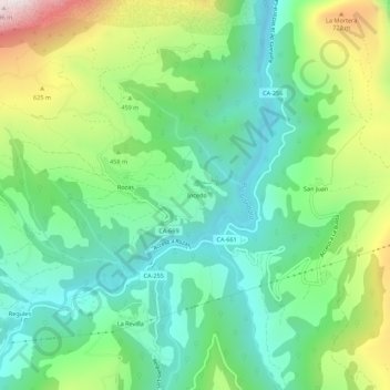
Name: Incedo topographic map, elevation, terrain.

Location: Incedo, Soba, Cantabria, 39808, Spain (43.19418 -3.49897 43.23418 -3.45897)

Average elevation: 1,296 ft

Minimum elevation: 371 ft

Maximum elevation: 3,255 ft

Gear up for your next adventure:

🪶Camping Sleeping Pad - Comfortable sleeping pad for backpacking
📶Vehicle Signal Boosters - Improve reception in rural areas while driving to trailheads
🪶Wildlife Field Guides - Learn animal tracking and species ID
🥄Camping Utensil Set - Lightweight utensils for outdoor meals
👟Trail Running Shoes - Lightweight shoes for trail runners

As an Amazon Associate, this site earns from qualifying purchases at no extra cost to you.