
Thank you for supporting this site ❤️
Make a donation
Make a donation
Gear up for your next adventure:
As an Amazon Associate, this site earns from qualifying purchases at no extra cost to you.
Sarwal topographic map
Click on the map to display elevation.
Thank you for supporting this site ❤️
Make a donation
Make a donation
Gear up for your next adventure:
As an Amazon Associate, this site earns from qualifying purchases at no extra cost to you.
About this map
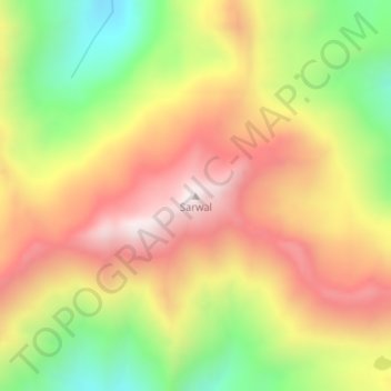
Name: Sarwal topographic map, elevation, terrain.
Location: Sarwal, Chhatroo, Kishtwar, Jammu and Kashmir, India (33.56015 75.68051 33.56025 75.68061)
Average elevation: 13,369 ft
Minimum elevation: 12,005 ft
Maximum elevation: 14,577 ft
Thank you for supporting this site ❤️
Make a donation
Make a donation
Gear up for your next adventure:
As an Amazon Associate, this site earns from qualifying purchases at no extra cost to you.