
Ratcliff topographic map
Click on the map to display elevation.
About this map
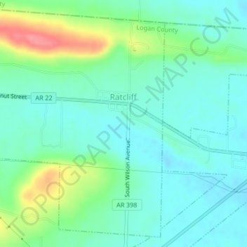
Name: Ratcliff topographic map, elevation, terrain.
Location: Ratcliff, Logan County, Arkansas, United States (35.29309 -93.90108 35.31800 -93.87796)
Average elevation: 453 ft
Minimum elevation: 381 ft
Maximum elevation: 646 ft
Logan County trails, hiking, mountain biking, running and outdoor activities
Other topographic maps
Click on a map to view its topography, its elevation and its terrain.
Mount Magazine State Park
United States > Arkansas > Logan County
There also exist many opportunities for ATV riding, backpacking, hang gliding, mountain biking, rappelling, and rock climbing within the park. The park hosts the annual Mount Magazine International Butterfly Festival, and is a haven for many rare species of butterflies in Arkansas due to the special blend of…
Average elevation: 2,188 ft