Geolocate

Giare topographic map

Click on the map to display elevation.

About this map

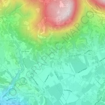
Name: Giare topographic map, elevation, terrain.

Location: Giare, Pesina, Caprino Veronese, Verona, Veneto, 37010, Italia (45.58186 10.73270 45.62186 10.77270)

Average elevation: 1,171 ft

Minimum elevation: 371 ft

Maximum elevation: 2,884 ft

Gear up for your next adventure:

🛡️Insect Repellent - Protection against bugs during outdoor activities
🗺️NatGeo Topo Maps - High-quality waterproof printed topographic maps of US Parks
🔥Fast-Boil Camping Stoves - Efficient cooking systems for quick trail meals
🧭Hiking Compass - Precision compass for reliable navigation in the wilderness
🪶Trail Camera - Capture wildlife on your hikes

As an Amazon Associate, this site earns from qualifying purchases at no extra cost to you.