
Thank you for supporting this site ❤️
Make a donation
Make a donation
Gear up for your next adventure:
As an Amazon Associate, this site earns from qualifying purchases at no extra cost to you.
Hof topographic map
Click on the map to display elevation.
Thank you for supporting this site ❤️
Make a donation
Make a donation
Gear up for your next adventure:
As an Amazon Associate, this site earns from qualifying purchases at no extra cost to you.
About this map
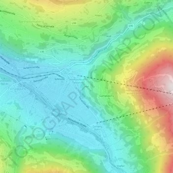
Name: Hof topographic map, elevation, terrain.
Location: Hof, Schruns, Bezirk Bludenz, Vorarlberg, 6780, Austria (47.05715 9.90646 47.09715 9.94646)
Average elevation: 3,163 ft
Minimum elevation: 2,146 ft
Maximum elevation: 5,594 ft
Thank you for supporting this site ❤️
Make a donation
Make a donation
Gear up for your next adventure:
As an Amazon Associate, this site earns from qualifying purchases at no extra cost to you.