
Thank you for supporting this site ❤️
Make a donation
Make a donation
Gear up for your next adventure:
As an Amazon Associate, this site earns from qualifying purchases at no extra cost to you.
Paltashaco topographic map
Click on the map to display elevation.
Thank you for supporting this site ❤️
Make a donation
Make a donation
Gear up for your next adventure:
As an Amazon Associate, this site earns from qualifying purchases at no extra cost to you.
About this map
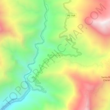
Name: Paltashaco topographic map, elevation, terrain.
Location: Paltashaco, Santa Catalina de Mossa, Morropón, Piura, Perú (-5.12290 -79.90489 -5.08290 -79.86489)
Average elevation: 3,350 ft
Minimum elevation: 1,440 ft
Maximum elevation: 5,663 ft
Thank you for supporting this site ❤️
Make a donation
Make a donation
Gear up for your next adventure:
As an Amazon Associate, this site earns from qualifying purchases at no extra cost to you.
Other topographic maps
Click on a map to view its topography, its elevation and its terrain.