
Thank you for supporting this site ❤️
Make a donation
Make a donation
Gear up for your next adventure:
As an Amazon Associate, this site earns from qualifying purchases at no extra cost to you.
Corire topographic map
Click on the map to display elevation.
Thank you for supporting this site ❤️
Make a donation
Make a donation
Gear up for your next adventure:
As an Amazon Associate, this site earns from qualifying purchases at no extra cost to you.
About this map
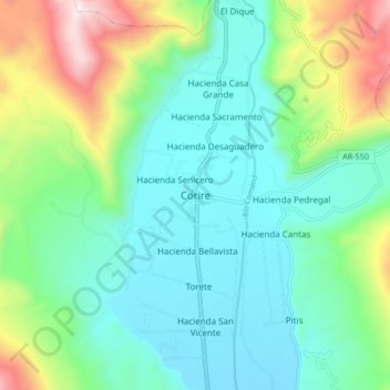
Name: Corire topographic map, elevation, terrain.
Location: Corire, Uraca, Castilla, Arequipa, Perú (-16.26292 -72.51106 -16.18292 -72.43106)
Average elevation: 2,178 ft
Minimum elevation: 1,270 ft
Maximum elevation: 4,731 ft
Thank you for supporting this site ❤️
Make a donation
Make a donation
Gear up for your next adventure:
As an Amazon Associate, this site earns from qualifying purchases at no extra cost to you.