Geolocate

Shell Lake topographic map

Click on the map to display elevation.

About this map

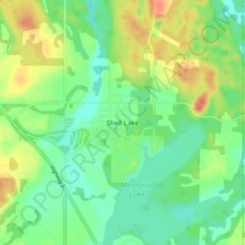
Name: Shell Lake topographic map, elevation, terrain.

Location: Shell Lake, Spiritwood No. 496, Saskatchewan, Canada (53.28540 -107.07881 53.32540 -107.03881)

Average elevation: 1,864 ft

Minimum elevation: 1,804 ft

Maximum elevation: 1,949 ft

Gear up for your next adventure:

🏔️Mountain Trail Maps - High‑detail maps for popular peaks
🔋Rechargeable Batteries - Power up your outdoor devices
📶Satellite Messenger - Communication device off‑grid
🔭Telescopic Hiking Pole - Adjustable pole for hiking stability
🥤Water Filter Bottle - All‑in‑one filter bottle for safe hydration

As an Amazon Associate, this site earns from qualifying purchases at no extra cost to you.