Geolocate

Chichubamba topographic map

Click on the map to display elevation.

About this map

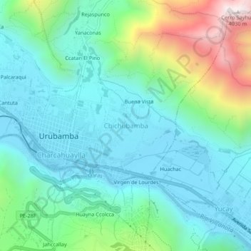
Name: Chichubamba topographic map, elevation, terrain.

Location: Chichubamba, Urubamba, Cusco, 08661, Peru (-13.32431 -72.12496 -13.28431 -72.08496)

Average elevation: 10,249 ft

Minimum elevation: 9,344 ft

Maximum elevation: 13,182 ft

Gear up for your next adventure:

🧭Outdoor Navigation Book - Learn advanced navigation skills
Backpacking Tent - Lightweight and durable tent for multi‑day hikes
🛡️Insect Repellent - Protection against bugs during outdoor activities
🚁Photography Drones - Capture stunning aerial views of landforms and topography
Backpacking Tents - Weight-optimized shelters for multi-day topographic surveys

As an Amazon Associate, this site earns from qualifying purchases at no extra cost to you.