
Thank you for supporting this site ❤️
Make a donation
Make a donation
Gear up for your next adventure:
As an Amazon Associate, this site earns from qualifying purchases at no extra cost to you.
Shijing topographic map
Click on the map to display elevation.
Thank you for supporting this site ❤️
Make a donation
Make a donation
Gear up for your next adventure:
As an Amazon Associate, this site earns from qualifying purchases at no extra cost to you.
About this map
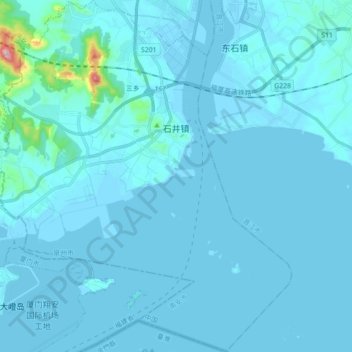
Name: Shijing topographic map, elevation, terrain.
Location: Shijing, Nan'an City, Quanzhou, Fujian, China (24.52861 118.32335 24.68878 118.48231)
Average elevation: 62 ft
Minimum elevation: -3 ft
Maximum elevation: 1,555 ft
Thank you for supporting this site ❤️
Make a donation
Make a donation
Gear up for your next adventure:
As an Amazon Associate, this site earns from qualifying purchases at no extra cost to you.