Geolocate

Sega topographic map

Click on the map to display elevation.

About this map

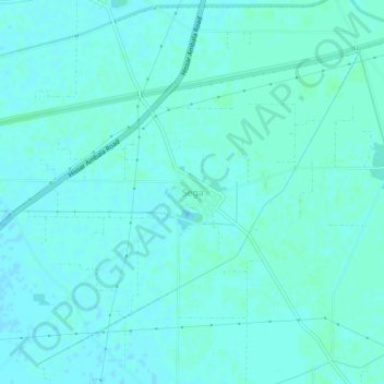
Name: Sega topographic map, elevation, terrain.

Location: Sega, Kaithal, Kaithal District, Haryana, India (29.73419 76.44950 29.77419 76.48950)

Average elevation: 781 ft

Minimum elevation: 774 ft

Maximum elevation: 791 ft

Gear up for your next adventure:

🎒Outdoor Daypacks - Lightweight backpacks designed for carrying maps and essential gear
🛠️Backpacking Tool Kit - Essential toolkit for outdoor repairs
📌Outdoor GPS Map App - Apps and devices for digital topographic navigation
🪶Paracord Bracelet - Survival bracelet with built‑in tools
🧺Microfiber Travel Towels - Compact and fast-drying towels for trail use

As an Amazon Associate, this site earns from qualifying purchases at no extra cost to you.