
Make a donation
Gear up for your next adventure:
As an Amazon Associate, this site earns from qualifying purchases at no extra cost to you.
Gleichenberg topographic map
Click on the map to display elevation.
Make a donation
Gear up for your next adventure:
As an Amazon Associate, this site earns from qualifying purchases at no extra cost to you.
About this map
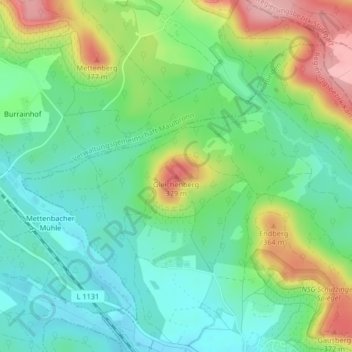
Name: Gleichenberg topographic map, elevation, terrain.
Location: Gleichenberg, Illingen, Enzkreis, Baden-Württemberg, Deutschland (49.01111 8.88721 49.01121 8.88731)
Average elevation: 984 ft
Minimum elevation: 827 ft
Maximum elevation: 1,283 ft
Make a donation
Gear up for your next adventure:
As an Amazon Associate, this site earns from qualifying purchases at no extra cost to you.
Other topographic maps
Click on a map to view its topography, its elevation and its terrain.
Illingen
Deutschland > Baden-Württemberg > Enzkreis > Illingen
Das Gemeindegebiet von Illingen liegt an der südlichen Flanke des Strombergs, etwa 30 km nordwestlich von Stuttgart, zwischen Vaihingen/Enz im Südosten und Mühlacker im Westen. Nördlich von Schützingen zieht sich der Höhenzug mit Gleichenberg (379,2 m), Endberg (363,7 m) und Gausberg (371,6 m) hin.…
Average elevation: 879 ft