Geolocate

Tekonsha topographic map

Click on the map to display elevation.

About this map

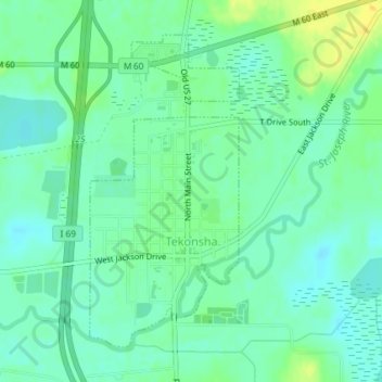
Name: Tekonsha topographic map, elevation, terrain.

Location: Tekonsha, Tekonsha Township, Calhoun County, Michigan, United States (42.08591 -84.99552 42.10799 -84.98127)

Average elevation: 948 ft

Minimum elevation: 919 ft

Maximum elevation: 994 ft

Calhoun County trails, hiking, mountain biking, running and outdoor activities

Other topographic maps

Click on a map to view its topography, its elevation and its terrain.

East Leroy

United States > Michigan > Calhoun County

Average elevation: 922 ft

White Lake

United States > Michigan > Calhoun County

Average elevation: 942 ft

Albion Landing

United States > Michigan > Calhoun County

Average elevation: 951 ft

Ceresco

United States > Michigan > Calhoun County

Average elevation: 909 ft

Marengo

United States > Michigan > Calhoun County

Average elevation: 961 ft

Eckford

United States > Michigan > Calhoun County

Average elevation: 974 ft

Pennfield

United States > Michigan > Calhoun County

Average elevation: 869 ft

Clarendon

United States > Michigan > Calhoun County

Average elevation: 981 ft

Bedford

United States > Michigan > Calhoun County

Average elevation: 896 ft

Gear up for your next adventure:

🏫Relief Map Kits - Hands-on tools for teaching landforms and elevation
🛌Ultralight Sleeping Bags - Compact down bags for cold nights in the wilderness
🔥Plasma Lighters - Windproof lighters that work in any weather condition
🛠️Outdoor Gear Repair Kit - Essential tools to fix gear on the trail
🥤Water Filter Bottle - All‑in‑one filter bottle for safe hydration

As an Amazon Associate, this site earns from qualifying purchases at no extra cost to you.