
Thank you for supporting this site ❤️
Make a donation
Make a donation
Gear up for your next adventure:
As an Amazon Associate, this site earns from qualifying purchases at no extra cost to you.
Lagginhorn topographic map
Click on the map to display elevation.
Thank you for supporting this site ❤️
Make a donation
Make a donation
Gear up for your next adventure:
As an Amazon Associate, this site earns from qualifying purchases at no extra cost to you.
About this map
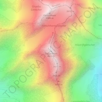
Name: Lagginhorn topographic map, elevation, terrain.
Location: Lagginhorn, Saas-Grund, Visp, Wallis, 3910, Schweiz (46.15701 8.00305 46.15711 8.00315)
Average elevation: 10,961 ft
Minimum elevation: 8,648 ft
Maximum elevation: 13,097 ft
Thank you for supporting this site ❤️
Make a donation
Make a donation
Gear up for your next adventure:
As an Amazon Associate, this site earns from qualifying purchases at no extra cost to you.